Measuring Nature: Why it is important and what it can do to help your business – Part 6
How do you buy satellite imagery?
Who do you buy it from?
Can you access free images?
Whilst it is fair to say the ability to purchase imagery from space has improved markedly, it is nowhere near as straight-forward as buying a car or washing machine. Our previous posts have highlighted some of the considerations you need to make when choosing the right imagery for your needs.

Can I access free data?
It is complex which is why many organisations prefer to rely on experts such as Agrimetrics to not only purchase the imagery on their behalf but help them to process the data and provide the outputs in an easily digestible format.
One question many organisations start with is, will free data meet my needs? As we all navigate a squeeze on finances, it is worth knowing that there are free-to-use sources of satellite imagery such as Sentinel and Landsat.
Building on previous satellite success over the last twenty years, the European Space Agency established the Copernicus Programme in 2014 and set about launching their ‘Sentinel’ missions into orbit. These provide data on the earth’s ecosystem and is freely available from several sources.
First launched in 1972, Landsat is the longest, continuously operating satellite mission – Landsat 9 was launched in 2012 – and now, under the management of the US Geological Survey, the data is freely available through several online viewers. For example, the archive from Landsat 8 (over 85,000 images) is on AWS.
There are other free sources, but these are the two main ones. Whether they are right for your applications depends on some of the considerations we’ve covered in previous posts such as number of bands, revisit time and coverage.

Where can I buy satellite imagery?
Whilst the number of free sources is quite sparse, the number of paid for sources is extensive as new companies enter the market. As part of paying for the data you get much more in the way of customer service but also an extra service called tasking.
If the image you want is not in the archive or you need an image at a specific time, you can task the satellite to capture what you need, when you need it. It is more expensive but given the application, it may justify the cost.
Some of the commercial options on the market include:
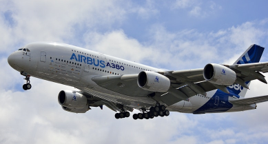
Airbus
Airbus has built and manages several satellite constellations including Pleiades Neo and SPOT. These allow Airbus to provide imagery that has a ground resolution of around twenty meters all the way down to 30 centimetres.
Planet
Planet have been at the vanguard of the ‘nanosat’ revolution. Where satellites were traditionally the size of a town bus and cost hundreds of millions to build, Planet saw a need for small, cheap to build sensors. Today, they are over 200 of their shoebox-sized satellites orbiting above us, beaming back 50-centimetre ground resolution imagery which is able to revisit the same place on earth, more than once a day.
ICEYE
Taking the nano-sat concept and running with it, ICEYE created a constellation of radar satellites, allowing them to see through clouds and at night. These twenty, small Synthetic Aperture Radar (SAR) satellites provide accurate measurements of field boundaries, detection of planting and harvest, and assessment of crop damage caused by natural disasters.
To find out more about how you can access satellite imagery for your business simply contact one of our team info@agrimetrics.co.uk
Other articles that might interest you

AI identifies crops from space with 90% accuracy
Agrimetrics launches CropLens AI, a proprietary algorithm that identifies crop types from space.

ClearSky: Cloud free satellite data for agriculture
ClearSky's artificial intelligence removes a major barrier to the efficacy of satellite

ClearSky: Cloud free satellite data for agriculture
ClearSky's artificial intelligence removes a major barrier to the efficacy of satellite

Agrimetrics partners with Airbus to reduce cost
Crop Analytics, a crop and field analytics package from Airbus, is now available at a new, lower price.


