
International standards on satellite data urgently needed
Agrimetrics study in Indonesia provides recommendations
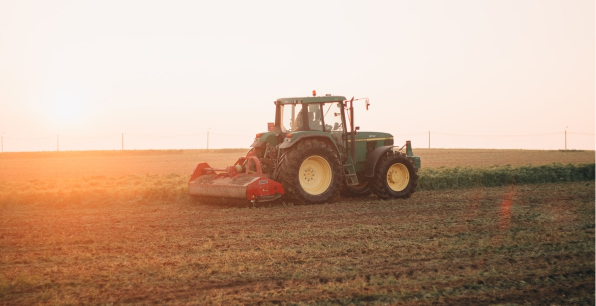
New research reveals the important role that advances in remote sensing can play in global land use management, but standard international practices in data capture and reporting are urgently needed to realise the opportunity.
Remote sensing has been used for 40 years to map land use and land cover but there is limited agreement over the classifications used. Agrimetrics, in a study with Unilever and the University of Leicester, analysed 15 years of data from three open-source, land use land cover datasets and found wide discrepancies. In a new paper it provides new insights and describes how the latest satellite imaging would provide the metrics that are essential to support climate change mitigation.
Lead author Sybrand van Beijma, of Agrimetrics and Rothamsted Research, said: “Without a scientific consensus on the metrics for measuring deforestation rates or associated carbon emissions it is impossible to monitor or enforce measures to mitigate climate change.
“The first step was to analyse the reasons for inconsistency in the current data and make recommendations for how they could be addressed.”
Working with the Unilever Safety and Environmental Assurance Centre, Agrimetrics selected three regions of Sumatra and Kalimantan in Indonesia as a case study. These areas combine peat soils, primary and secondary forest and new plantation developments and were therefore considered representative of the region.
There are historical records of land use dating back 20 years, based on Landsat optical images and other Earth Observation (EO) derived datasets. As the information comes from a variety of sources, the team needed to assess the level of accuracy and trust in the data.
Three open-source satellite-derived datasets for the period 2000 – 2015 were compared, obtained from the European Space Agency Climate Change Initiative, the Centre for Remote Imaging, Sensing and Processing in Singapore, and the Indonesian Ministry of Forestry.
To make the data comparable it was aggregated into nine broad land use land cover classes and change maps were created for the two periods where all three data sets were updated.
A Map Curve analysis showed that, even with this adjustment, large inconsistencies existed in the data set. A pixel-by-pixel comparison showed less than 62% agreement. The discrepancy could be due to the resolution of the imaging not being fine enough to determine boundaries between classes, and to poor visibility through persistent cloud cover.
This suggests that adoption of emerging imaging techniques, such as Synthetic Aperture Radar on the recently launched Copernicus Sentinel satellites, could greatly improve accuracy of mapping, as it is unaffected by cloud. Additionally, the new instrumentation provides high-resolution radar images that enable the visualisation of canopy size and texture so that foliage can be classified more accurately as forest or plantation.
Deforestation and changes in land use may lead to the release of stored carbon as carbon dioxide and other greenhouse gases. Reliable and comparable methods to estimate carbon losses from land use and land use change are important for climate change management.
To assess the levels of historical carbon dioxide emissions from land use change, Agrimetrics collaborated with Professor Sue Page, a specialist in tropical peat lands at University of Leicester. Her department is looking at carbon storage and gas emissions; including the use of remote satellite monitoring of carbon stocks.
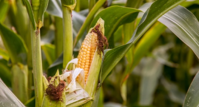
The study area in Indonesia produces 51 per cent of the world’s palm oil and the plantations cover both mineral and organic (peat) soils and has undergone significant land use change in the past 20 years.
The Agrimetrics model described in the paper estimates that a transition from primary forest to shrubland would release significant carbon, but if this land then becomes palm oil plantation its biomass would sequester the carbon, reducing the perceived carbon loss. This work provides insights into the need for better methods of remote monitoring of carbon cycles – which impact soil fertility, biodiversity and climate change – to allow assessment across the lifecycle of land use change.
Sybrand comments: “The method described in this paper can be used to provide spatially-improved estimates of land use and land cover changes and to estimate greenhouse gas emissions, but it also reveals a fundamental lack of consistency in classifications.
“To be most effective, there is a need for consensus building and harmonisation of methods and categories used to provide the foundations needed to develop a consistent and robust approach to assessing change. This is essential to support measures to mitigate climate change that can be reinforced by industry and government policy.”
The paper
To cite this article: Sybrand van Beijma, Julia Chatterton, Susan Page, Chris Rawlings, Richard Tiffin & Henry King (2018): The challenges of using satellite data sets to assess historical land use change and associated greenhouse gas emissions: a case study of three Indonesian provinces, published in Carbon Management.
Other articles that might interest you
AI identifies crops from space with 90% accuracy
Agrimetrics launches CropLens AI, a proprietary algorithm that identifies crop types from space.
ClearSky: Cloud free satellite data for agriculture
ClearSky's artificial intelligence removes a major barrier to the efficacy of satellite
ClearSky: Cloud free satellite data for agriculture
ClearSky's artificial intelligence removes a major barrier to the efficacy of satellite
Agrimetrics partners with Airbus to reduce cost
Crop Analytics, a crop and field analytics package from Airbus, is now available at a new, lower price.
Sign up for Agrimetrics newsletter
To get regular updates on new data sets, tips, trends and case studies, please subscribe to the Agrimetrics newsletter.

