
Measuring Nature: Why it is important and what it can do to help your business – Part 3
What does revisit time mean?
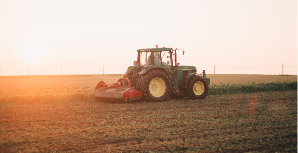
How can Landsat imagery help farming?
What is a satellite constellation?
In our Measuring Nature series, we have looked at what details can be seen from space and how satellite images can see beyond the human eye to reveal hidden insights into crop health.
In this edition, we will look at the importance of revisit times, which is the amount of time it takes for a satellite to circle the earth and return over our heads.
Why does revisit time matter?
We take photographs to capture special moments that we would like to remember. They are a snapshot in time on a particular day. And satellite imagery is no different. They capture the land and the crops as they were the exact moment the satellite passes overhead.

This way of capturing images comes with both advantages and disadvantages. The advantage is that we have a permanent record of the extent and health of our crops on that day, meaning we can act upon the information. But, as we know, things can change very quickly on farms.
We need the insights that we can generate from space-based imagery to be as timely as possible so that we can be confident that we are making the best decisions. So, the revisit time – the time it takes for a satellite to come back round overhead – is another vital consideration when we are selecting which sensors and which data to use.
Updated insights in just over two weeks
Since 1972, Landsat has been the longest running, continuous earth observation programme. Ever since US government launched the Earth Resources Technology Satellite (renamed Landsat in 1975), this series of single satellite missions has been sending back images of the earth’s surface using between 4 and 11 bands and has been fundamental in agricultural monitoring and management.

Each Landsat satellite can image the entire planet in 16 days. So, in just over two weeks, it is possible to get an updated view of our farms and the landscape, assuming the cloud doesn’t get in the way. Such a length of time between updated imagery can be acceptable for many food and farming monitoring projects. However, if the situation on the ground is fast-moving, how can we shorten that time?
More satellites, fewer delays
By having more satellites, in what is known as a constellation, the time between a satellite revisiting the same place can be dramatically reduced. Each Landsat satellite, whilst launched on its own, combines imagery from Landsat 8 and Landsat 9, in order to photograph our fields with free data, every eight days.
Whilst that is a significant improvement from the standard 16 days, some commercial organisations disagree and have created constellations to reduce this waiting time even further. Some have even got it down to a day.
So, in our quest to understand how earth observation data can improve efficiency and output in farming and food production, we have looked at spatial (size on the ground) and temporal (revisit times) resolutions as well as wavelength bands.
Next, we will look to move from two dimensional views from space to using data from satellites to create 3D representations of our land.
Glossary
Revisit time – the time it takes for a satellite to return to view the same place on the surface of the earth.
Band – the specific portion of radiation that the satellite sensor can detect
Satellite Constellation – a collection of satellites working together to build as complete observation of the earth surface as possible.
Other articles that might interest you
AI identifies crops from space with 90% accuracy
Agrimetrics launches CropLens AI, a proprietary algorithm that identifies crop types from space.
ClearSky: Cloud free satellite data for agriculture
ClearSky's artificial intelligence removes a major barrier to the efficacy of satellite
ClearSky: Cloud free satellite data for agriculture
ClearSky's artificial intelligence removes a major barrier to the efficacy of satellite
Agrimetrics partners with Airbus to reduce cost
Crop Analytics, a crop and field analytics package from Airbus, is now available at a new, lower price.
Sign up for Agrimetrics newsletter
To get regular updates on new data sets, tips, trends and case studies, please subscribe to the Agrimetrics newsletter.

